 AgriTech.trNews
News
Article, guide, interview, and sector note archive.

From field imagery to field decisions: Agrovech and Türkiye's emerging AI agriculture layer
Agrovech's public work around satellite imagery, drone data and AI points to a larger shift in Turkish agritech: the move from observation tools toward decision-ready agricultural intelligence, with stronger evidence standards for field claims.
Agrovech seeks to turn satellite and drone data into field decisions for Turkish agriculture
The Turkish agritech company is developing AI-supported agricultural intelligence tools as remote sensing, digital monitoring and artificial intelligence gain a larger role in Türkiye’s agricultural technology landscape. The next test will be whether those capabilities can deliver measurable results in the field.
Agriculture is generating more data than ever. Satellites can repeatedly observe large production areas, drones can capture detailed field imagery and digital farm records can provide information on crops, planting schedules and previous interventions.
The more difficult question is what to do with that information.
Turkish agricultural technology company Agrovech is among the businesses attempting to answer that question by combining satellite imagery, drone data and artificial intelligence to support agricultural monitoring and field-level decisions.
According to the company’s public materials, Agrovech’s technology is positioned around crop-health and stress monitoring, irrigation and fertilisation optimisation, yield estimation, tassel detection, sustainability indices and carbon-footprint analysis.
The range of applications is broad, but the underlying proposition is relatively focused: turning field observations into information that can help a farmer, agronomist or agricultural business decide where to look and when to act.
That places Agrovech in a growing agricultural technology category in which the value of remote sensing is increasingly judged not by the quality of an image or map alone, but by whether the analysis can lead to an earlier, more targeted or more reliable agricultural decision.
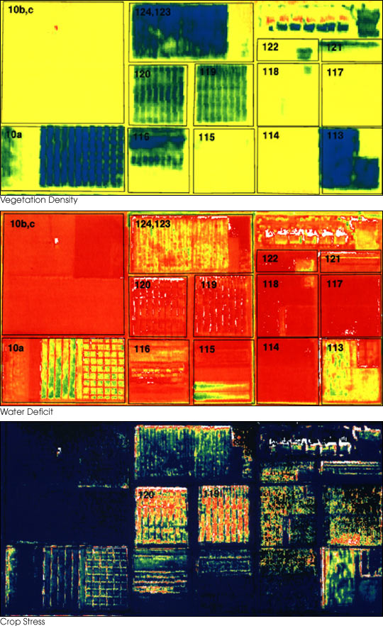
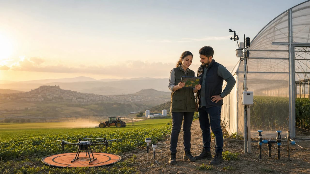
The images in this article are contextual, legally reusable illustrations of remote sensing, NDVI-style interpretation, and agricultural drone workflows. They are not presented as Agrovech customer fields, Agrovech output, or proof of Agrovech performance.
The challenge is no longer simply seeing the field
Satellite imagery has been used in agricultural observation for years. Drone technology has also made detailed field-level imagery more accessible.
The challenge for the next generation of agricultural intelligence platforms is interpretation.
A production team monitoring a large number of fields may be able to identify differences in vegetation, plant development or other field conditions through remote imagery. But a visible difference is not automatically a recommendation.
The operational questions are more demanding.
Which parcel should be inspected first? Has a field changed significantly since the previous observation? Is an identified anomaly likely to require intervention, or should it simply be monitored? Could irrigation, fertilisation or field-scouting resources be directed more precisely?
Agrovech’s public positioning suggests that it is trying to operate in this space between data collection and agricultural action.
Its satellite and drone inputs are used as the basis for AI-supported analysis, with the resulting signals applied to areas including plant health, crop stress and yield-related assessments.
For a farmer operating a limited number of fields, direct knowledge of the land and regular physical inspection remain central to production management.
The economics of monitoring begin to change, however, when the number of production sites increases.
Large growers, agricultural advisers, cooperatives, food processors working with contract producers and other agribusinesses may need visibility across hundreds or thousands of parcels. Repeated manual scouting remains important, but it becomes more difficult to use as the only method of identifying where attention is most urgently required.
Remote sensing can potentially provide a prioritisation layer.
The technology does not eliminate the need for agronomic expertise or field validation. Its potential value lies in helping agricultural teams direct limited time and resources towards the locations or signals that deserve closer investigation.
For platforms such as Agrovech, that distinction is important. The commercial product is not simply a satellite image. It is the process through which an observation is interpreted, prioritised and incorporated into an agricultural workflow.
Türkiye’s agricultural AI environment is becoming more visible
Agrovech’s development also comes as several parts of Türkiye’s agricultural technology ecosystem move towards greater use of artificial intelligence and remote monitoring.
The trend can be seen across startup development, public research and innovation programmes, national monitoring activities and technology competitions.
TÜBİTAK’s 1711 Artificial Intelligence Ecosystem Call for 2026 includes smart agriculture, food and livestock among its priority areas.
The relevance of that programme extends beyond the availability of AI funding.
Agricultural artificial intelligence is rarely a software-only problem. A system designed to detect field stress, estimate production or support an irrigation decision may require access to agricultural data, agronomic expertise and repeated comparison between model outputs and actual field conditions.
A serious deployment can therefore involve a producer or agricultural company with a defined operational problem, a technology provider, field data and technical expertise, followed by repeated validation in real production environments.
This makes agriculture particularly suited to programmes that encourage collaboration between technology developers, research organisations and businesses.
For companies working in Agrovech’s category, the challenge is not simply to build a detection model. The more difficult task is connecting a technical capability to a defined agricultural problem and then demonstrating that the resulting information can be used in an actual production process.
Türkiye also has experience with agricultural monitoring at a much larger scale.
Türksat has reported the use of AI-supported satellite analysis to monitor agricultural production across more than 45 million decares, together with field-validation activity.
That work does not validate Agrovech or another individual commercial platform. It does, however, provide an important signal for the wider technology category.
Remote sensing in Turkish agriculture is no longer relevant only as a small experimental concept. Satellite-based analysis is already being used in agricultural monitoring at national scale.
As public infrastructure and commercial platforms begin to use similar underlying technologies, the competitive question changes.
The question is no longer simply whether satellite imagery can be used in agriculture.
It becomes: which agricultural problem can a company solve more reliably, more quickly or at a more useful scale with that imagery?
From another agricultural dashboard to a decision system
This is likely to become one of the central product questions for agricultural intelligence companies.
Farmers and agronomists have access to a growing number of maps, indices, sensors and digital dashboards. Adding another source of data does not necessarily improve a farming operation.
A useful agricultural intelligence system needs to reduce uncertainty or improve the timing of a decision.
For example, a vegetation signal may identify variation within a production area. The agricultural value begins when the user can determine whether the variation is important, whether a field inspection is required and whether the information has arrived early enough to influence the outcome.
The same principle applies to yield estimation.
A production forecast becomes operationally useful when it is sufficiently accurate and available at a point when a farmer, processor or other agricultural business can use it for planning.
Irrigation and fertilisation analysis face a similar test. The important measurement is not whether a platform can display field differences, but whether the resulting information can support better targeting or timing of inputs.
Agrovech publicly lists all of these areas among its agricultural applications.
The available material establishes the company’s technology focus and intended uses. It does not, on its own, establish independently verified yield gains, water or fertiliser savings, model accuracy across different crops or farmer-level financial returns attributable to the platform.
That distinction is particularly important in agricultural technology reporting.
Artificial intelligence, satellites and drones are attractive technology categories, and companies can often describe a wide range of possible applications. Commercial and agronomic performance, however, depends on evidence from real production environments.
For Agrovech and similar companies, some of the most significant indicators will therefore be relatively practical.
How early can the system identify a relevant field problem? How are satellite or drone signals checked against physical observations? Does performance remain consistent across crops and production regions? Can agronomists understand the confidence of an identified signal? Does the information integrate into an existing field-management process?
And ultimately, does the user gain economically?
These questions are likely to determine which agricultural intelligence platforms develop into embedded production tools and which remain primarily monitoring products.
A useful way of considering the category is through four factors: coverage, timing, confidence and actionability.
Coverage determines whether the technology can monitor enough agricultural land to be operationally relevant.
Timing determines whether information arrives while a producer can still respond.
Confidence determines whether farmers and agricultural professionals trust the analysis.
Actionability determines whether the information leads to a clear next step.
Weakness in any one of these areas can limit field value. Wide coverage is less useful if the signal cannot be trusted. Highly accurate information has limited operational value when it arrives after the relevant intervention period. Detailed analysis can also create additional complexity if the user does not understand what action should follow.
The companies able to connect all four factors are more likely to demonstrate measurable value in agricultural production.
Editorial evidence ladder
The strongest way to cover Agrovech and similar companies is to separate category evidence from product evidence. Public sources can confirm that the category is active. Field records are still needed before a newsroom can confirm agronomic or financial results.
| Evidence layer | What it can support | What it cannot support by itself |
|---|---|---|
| Event participation | International visibility, ecosystem context, partner interest | Yield, savings, adoption, retention, accuracy |
| Company profile | Stated product scope and intended use cases | Independent field performance |
| Product listing | Package, price, feature language, target customer | Agronomic value across crops and regions |
| Public-sector program | National AI, satellite, or digital-agriculture context | Supplier-level validation |
| Field deployment record | Crop, area, baseline, intervention, measurement method | Universal transferability without more cases |
International visibility adds another dimension
Agrovech was also among the technology ventures associated with the Yıldız Technopark ecosystem presented during London Tech Week 2026.
Yıldız Technical University’s coverage of the event identified Agrovech among the startups and partner companies connected with the Turkish technology presence.
For an agritech company, international technology events can create opportunities for investor discussions, commercial partnerships and entry into new markets.
Agricultural technologies can also have export potential when a production problem exists across different geographies. Water management, large-scale crop monitoring and the need to identify production risks are not unique to Türkiye.
But international visibility should be separated from agricultural validation.
Participation in an overseas technology event shows ecosystem and internationalisation activity. It does not demonstrate that a product has improved crop yields or reduced agricultural inputs.
For Agrovech, the more consequential developments will be found in its field deployments and customer workflows.
The crops being monitored, the regions in which the platform is used, the total agricultural area under observation and the methods used to validate identified signals will provide a clearer picture of its agricultural position.
Commercial adoption will also matter.
Agricultural intelligence platforms can potentially serve individual growers, cooperatives, agricultural advisers, processors, input companies, insurers, financial institutions and public programmes. Each customer group has different requirements and a different definition of value.
A farmer may focus on the timing of an intervention.
A food processor working with contract growers may need a more consistent view of production conditions across a supply network.
An insurer or financial institution may be more interested in standardised monitoring and risk information.
The ability of platforms such as Agrovech to specialise or integrate into these different agricultural workflows could become as important as the underlying AI models.
What to watch next
The useful next reporting will not be another generic AI-in-agriculture headline. It will be a deployment file.
| Reporting question | Minimum useful answer | Better answer |
|---|---|---|
| Area monitored | Hectares, parcels, crop groups, observation frequency | Named crop-region combinations over a stated season |
| Validation method | How model signals are checked | Ground observations, agronomist notes, and error/confidence records |
| Decision workflow | Who receives the alert and what action follows | Exportable task logs and before/after decision records |
| Water or input claim | Baseline, crop, period, weather, and comparison method | Metered water or input records plus yield/quality context |
| Commercial fit | Customer group and payment model | Retention, renewal, support, and integration evidence |
The next phase will be measured in the field
Türkiye has many of the components required for a larger agricultural intelligence industry.
The country has agricultural production at scale, satellite capabilities, universities, technoparks, artificial intelligence programmes and a growing technology entrepreneurship ecosystem.
Public-sector agricultural monitoring is becoming more digital. Applied AI funding includes agriculture among its priorities. Technology companies are packaging satellite and drone capabilities into commercial products.
The next challenge is connecting those elements to agricultural systems that work reliably under real production conditions.
Agrovech is one of the Turkish companies attempting to build that connection.
Its public technology positioning reflects the direction in which a wider part of the agritech sector is moving: away from the simple collection of field data and towards systems designed to interpret agricultural conditions and support decisions.
The evidence from deployments will now be more important than the technology category itself.
For Agrovech, the key developments to watch will include the agricultural area monitored by its systems, crop-specific deployments, field-validation methods, yield-estimation performance and documented effects on water, inputs or operating costs.
Those measurements will help determine whether the company’s satellite, drone and AI capabilities can move from agricultural monitoring to something more consequential: a trusted decision layer for farms and agricultural businesses.
For Türkiye’s wider agritech sector, the question is similar.
The infrastructure for agricultural intelligence is becoming more visible.
The next phase is proving what it can change in the field.
Asset rights and claim boundary
The article now uses reusable contextual assets rather than treating a commercial product image as open media.
| Asset | Use in this article | Rights basis |
|---|---|---|
| False-color NDVI wheat-field image | Cover and body visual for remote-sensing interpretation | Wikimedia Commons, Antarsih, CC BY 4.0 |
| Antalya Landsat farming image | Gallery visual for Turkish agricultural observation context | NASA Earth Observatory / USGS Landsat; NASA reuse guidance applies |
| NASA/USDA precision-farming comparison | Body and gallery visual for evidence layers | Public-domain U.S. Government work |
| Drone crop fertilizer setup | Gallery visual for field-technology context | Wikimedia Commons, CC0 1.0 |
Confirmed: public sources identify Agrovech in the YTU London Tech Week 2026 ecosystem and describe the company’s public positioning around AI, satellite analytics, drone-based insights, and farmer-facing digital tools. Inferred by AgriTech.tr: the evidence ladder and decision-chain framework are editorial tools for evaluating this category. Not verified here: field-level yield gains, water savings, fertilizer savings, model accuracy, customer retention, or return on investment attributable to Agrovech.
Sources and related material
- Yıldız Technical University, The Technological Strength of the YTÜ Ecosystem Was Showcased at London Tech Week 2026, 11 June 2026
- Take Off Istanbul, Agrovech startup profile
- Agrovech public company and product materials
- TÜBİTAK 1711 Artificial Intelligence Ecosystem Call, 2026
- Ministry of Agriculture and Forestry material on AI-supported digital transformation and water efficiency
- TEKNOFEST Agriculture Technologies Competition, 2026
- Türksat material on AI-supported satellite agricultural production monitoring
Media
Source visuals and related article assets.


Continue reading
Recent coverage from AgriTech.tr.
Top 30 Agricultural Technology Companies in Türkiye
A source-led, alphabetical map of 30 Türkiye-headquartered companies working across precision machinery, farm software, sensors, water technology, livestock monitoring, automation and data-enabled production, with stronger attention to Central Anatolia’s strategic needs.
 AgriTech.tr Research Desk18 Jul 2026 · 19 min read
Top 30 Turkish Agritech Exporters in 2026
An evidence-led watchlist of 30 Turkish agritech exporters showing current signals in machinery, irrigation, greenhouse systems, digital tools and production technology. “To watch” identifies companies meriting further buyer research; it is not a growth forecast, investment recommendation or guarantee of export performance.
AgriTech.tr Research Desk18 Jul 2026 · 21 min read