تقييم AgriTech.tr
صياغة تحريرية وإرشادات مقارنة أُعدّت للمساعدة في تحديد المتطلبات.
 AgriTech.trالتقنيات
التقنيات
أدلة شراء فنية ومواصفات توريد للمنتجات والمعدات الزراعية.
GNSS guidance and field-operation tracking equipment
A rugged 10-inch visual guidance system for tractors and combines using GNSS with EGNOS correction, straight, curved and free A-B lines, task and field recording, pass tracking, overlap reduction, and installation options for mixed machinery fleets.
 صورة توضيحية
منشأ التوريد
تركيا
نطاق المشتريات
مواصفة توريد
آخر مراجعة
13/07/2026
صياغة تحريرية وإرشادات مقارنة أُعدّت للمساعدة في تحديد المتطلبات.
نطاقات تخطيطية وليست تكوينًا نهائيًا مضمونًا.
تدعم المواد العامة السياق الفني؛ ولا تزال التفاصيل التجارية الحالية بحاجة إلى تأكيد.
GNSS guidance and field-operation tracking equipment
المعلمات الفنية المستخدمة لتحديد المتطلب ومقارنة التكوينات المؤكدة من المورّدين.
10-inch GNSS tractor guidance and field-pass tracking configuration
Visual GNSS tractor and combine guidance system for repeated field passes
EGNOS-compatible SBAS correction with no direct correction-subscription charge; regional coverage and receiver compatibility apply
±30 cm reference value; pass-to-pass or absolute metric, confidence, time interval, test conditions, and field acceptance method are defined in the quotation
A-B straight, A-B curve, and A-B free
المعلمات الفنية المستخدمة لتحديد المتطلب ومقارنة التكوينات المؤكدة من المورّدين.
تفاصيل عملية تساعد الأشخاص على مقارنة الخيارات.
Visual GNSS guidance for spraying and fertilization where repeated field passes and working-width consistency influence overlap and missed-strip risk.
Broad-acre tillage and seedbed-preparation workflows requiring A-B straight, curve, or free guidance patterns.
Sowing and repeated-pass operations where the farm first needs operator guidance; higher-precision repeatability requirements should be compared separately with RTK and automatic-steering architectures.
Tractor and combine fleets evaluating a guidance display whose mounting, antenna, power supply, machine compatibility, and support scope are verified for every named machine.
Operations that want task and field recording but must verify export formats, data ownership, interoperability, and record-retention details before treating the system as a farm-data platform.
Farms comparing a lower-complexity GNSS guidance layer against automatic steering, ISOBUS section control, flow and rate control, fleet tracking, or an integrated precision-agriculture stack.
تتطلب هوية المورّد والمنشأ والتوفر والتكوين النهائي والشهادات والسعر ومدة التوريد والضمان والتسليم وشروط العقد تأكيدًا حاليًا.
المنهج والمصادر والسياق المستخدم في إعداد صفحة البحث هذه.
This profile defines a sourcing requirement for GNSS tractor guidance system. Suitable suppliers, origin, availability, and commercial terms are confirmed for the buyer’s project. The sourcing brief is structured around capacity, application, operating environment, required standards, destination, and delivery scope; the exact configuration requires supplier confirmation.
For farms comparing tractor GPS guidance systems in Türkiye, successful field operation depends on whether the system can help an operator hold repeatable working lines at the accuracy required by spraying, fertilization, tillage, sowing, or harvesting, and whether installation and support match the actual machine fleet.
| Technical layer | Technical capability | Project specification |
|---|---|---|
| GNSS correction | EGNOS-corrected visual guidance with a ±30 cm reference value. | Define pass-to-pass versus absolute accuracy, statistic, time interval, confidence, satellite conditions, speed, terrain, and acceptance test. |
| Guidance patterns | A–B straight, A–B curve, free guidance, headland handling, and field-pass visualization. | Test actual field geometry, working width, offsets, line creation, pause/resume, reacquisition, and operator workflow. |
| Task and field records | Field, operation, implement, working width, area, path, and task records. | Define storage, identifiers, export, file transfer, account ownership, retention, and farm-management integration. |
| Operator display | 10-inch / 26 cm touchscreen, 4 GB RAM, 64 GB storage, and IP67-rated housing. | Test sunlight visibility, gloves, cab mounting, vibration, heat, dust, language, boot time, and operator setup. |
| Connectivity | Bluetooth, Wi-Fi, SIM slot, USB 2.0, and USB Type-C interfaces. | Assign each interface to guidance, correction, updates, data transfer, support, or optional services and define cybersecurity. |
| Power | 12 V machine supply with internal backup battery. | Define fuse protection, cable routing, grounding, transient protection, shutdown, sleep current, and installation responsibility. |
| Auxiliary hardware | Optional rear-view camera, phone holder, antenna, brackets, and machine-specific harnesses. | Itemize included hardware, mounting, field of view, cable routing, ingress protection, and compatibility. |
| Machine fit | Adaptable installation for tractors and combines. | Confirm every named machine, cab layout, antenna position, implement offset, vibration, visibility, service access, and support. |
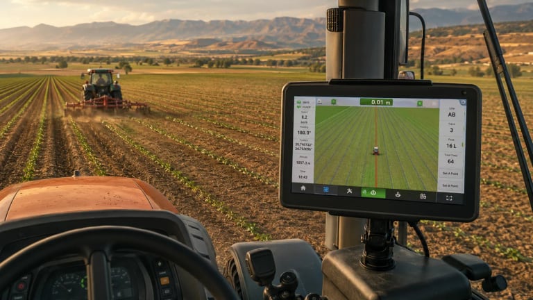
Field-pass pattern for precision-farming context. Photo by Bernd Dittrich on Unsplash. Image source · Unsplash License.
The strongest fit is usually in repeated field-pass operations where overlap and missed strips create avoidable cost, uneven application, or operator stress. Typical comparison scenarios include:
The display-based guidance configuration uses EGNOS correction and a ±30 cm reference guidance value. The project defines the metric—pass-to-pass or absolute, time interval, confidence level, antenna and receiver configuration, satellite visibility, speed, terrain, and post-interruption behavior—and verifies it on the buyer’s machine and field.
EGNOS Open Service is a satellite-based augmentation service for compatible GPS/SBAS receivers in its service area. Service-level positioning characteristics do not replace the pass-to-pass accuracy, receiver filtering, antenna placement, and field-performance specification required for a particular tractor installation.
The GNSS antenna is positioned on a rigid, repeatable machine reference point with a clear sky view and measured offsets to the tractor centreline, rear axle, implement hitch, and working element. The installation schedule records antenna height, lateral and longitudinal offsets, bracket stiffness, cable routing, connector sealing, electrical supply, vibration exposure, and whether the antenna is moved between machines.
Machine setup stores the actual implement width, overlap allowance, left/right offset, hitch geometry, operating speed range, and field-operation profile. Commissioning checks straight and curved lines, headland turns, pause and resume, loss and reacquisition of correction, return after a power cycle, cross-track display, area calculation, task export, and operator recovery from an incorrect line or width setting.
The field acceptance run uses marked passes or an independent reference method over an agreed distance and time interval. Results are recorded as cross-track error, repeatability, missed strip, overlap, reacquisition time, and operator workload for the intended spraying, fertilizing, tillage, sowing, or harvesting task.
The acceptance protocol records the accuracy metric, test conditions, antenna and receiver configuration, time interval, satellite visibility, operating speed, line length, cross-track error, reacquisition behavior, and expected performance after a guidance interruption. Measured field performance is tied to the complete installed system, not inferred from the correction-service name alone.
A visual EGNOS guidance system can be a practical entry point for farms seeking better pass consistency without immediately building a high-accuracy steering stack. It should not automatically be compared as equivalent to an RTK automatic-steering system. The correct comparison depends on the field operation, required repeatability, crop value, implement control, labor model, and service coverage.
The sourcing brief can be used to define the application, technical interfaces, documentation, and service requirements before supplier research begins. For project configuration and a technical quotation, contact info@agritech.tr.
The cover and in-article photographs provide field-pass and precision-farming context and are used under the Unsplash License. Photographer and source credits are retained in the reference section.
AgriTech.tr can structure the technical requirement and compare current supplier responses for the buyer’s project. Installation, commissioning, operator training, warranty, spare-parts, and after-sales scope must be confirmed in each supplier quotation. The final scope should be documented against the approved application, capacity, site conditions, destination, and delivery schedule in the selected supplier quotation and contract.
المنهج والمصادر والسياق المستخدم في إعداد صفحة البحث هذه.
Technical reference used for system specification, project engineering, and procurement planning.
Technical reference used for system specification, project engineering, and procurement planning.
Technical reference used for system specification, project engineering, and procurement planning.
Technical reference used for system specification, project engineering, and procurement planning.
Technical reference used for system specification, project engineering, and procurement planning.
Technical reference used for system specification, project engineering, and procurement planning.
Technical reference used for system specification, project engineering, and procurement planning.
المصادر المرجعية
توضّح المؤشرات مصدر المعلومات العامة وما لا يزال بحاجة إلى تأكيد. وهي ليست شارات اعتماد للمورّدين.
تقييم AgriTech.tr
صياغة تحريرية وإرشادات مقارنة أُعدّت للمساعدة في تحديد المتطلبات.
نطاقات هندسية نموذجية
نطاقات تخطيطية وليست تكوينًا نهائيًا مضمونًا.
7 مصادر عامة
تدعم المواد العامة السياق الفني؛ ولا تزال التفاصيل التجارية الحالية بحاجة إلى تأكيد.
ادعاءات مقدّمة من المورّد
لا يتضمن ملف الأدلة هذا أي ادعاء مقدّم من مورّد.
معلومات تم التحقق منها بالوثائق
لا يوجد سجل تحقق أساسي مرفق بهذا الإدراج.
صور الإدراج
الصور توضيحية وقد لا تُظهر التكوين النهائي الذي سيتم توريده.
